
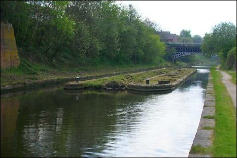
Photo: Derelict gauging station island at Engine Arm Aqueduct, Smethwick on the BCN.
Canal Gauging Station
Gauging Stations were used by the canal companies to accurately measure the depth the loaded narrowboats floated in the canal water to assess the load the boat was carrying.There would have been a covered gantry where boats were loaded with weights, plated and calibrated. The boat was calibrated by measuring the height of the gunwales above water level at each corner with the boat unladen and then measured again when known weights had been loaded into the boat from an overhead gantry.At toll offices if a toll collector suspected an incorrect waybill (declared cargo) the height of the four corners of the boat were checked with a gauging stick and averaged to allow for uneven cargo loading. This was used to fix the Toll to be paid for passing through this section of canal. That boat's entry in the gauging table was used to determine the cargo weight and the toll fee was worked out from the weight and cargo type. This was used to fix the Toll to be paid for passing through this section of canal.
We have no information on Lichfield Canal Gauging Station.
| Access: | |
| Alignment: | On canal line |
| Huddlesford: | 0.02 Miles (0.02 Kms.) |
| Catshill: | 8.60 Miles (14.00 Kms.) |
52.68309, -1.77744
